


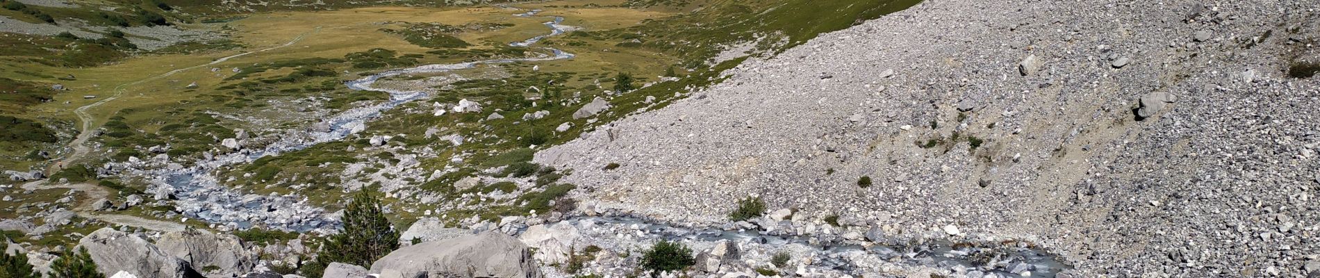
valllon du fruit

begnez
User
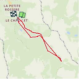

Length
12.6 km

Max alt
2216 m

Uphill gradient
706 m
Km-Effort
22 km

Min alt
1687 m

Downhill gradient
701 m
Boucle
Yes
Creation date :
2019-09-12 07:06:13.039
Updated on :
2019-09-12 15:38:08.562
4h37
Difficulty : Easy

FREE GPS app for hiking
 SityTrail
IGN / Geographical institutes
SityTrail Plus
The world is yours!
About
Trail Walking of 12.6 km to be discovered at Auvergne-Rhône-Alpes, Savoy, Les Allues. This trail is proposed by begnez.
Photos


Positioning
Country:
France
Region :
Auvergne-Rhône-Alpes
Department/Province :
Savoy
Municipality :
Les Allues
Location:
Unknown
Start:(Dec)
Start:(UTM)
310803 ; 5026745 (32T) N.
Comments